Move-in Special
Get Up to 2 Months Free Base Rent!*
*Minimum lease terms apply. Other costs and fees excluded.
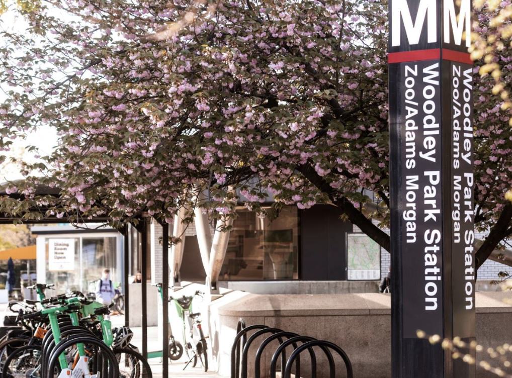
Woodley Park is built around easy Metro access that makes it easy to to move between the neighborhood and the rest of DC. The Woodley Park–Zoo/Adams Morgan Metro station is the neighborhood’s main transit hub, sitting right on Connecticut Avenue for quick access to the Red Line. Most residents use this station for daily commuting, with Cleveland Park just one stop north for additional convenience.
1. Woodley Park–Zoo / Adams Morgan Station (Red Line)
Location: Connecticut Ave NW & Woodley Rd NW
This is the main station for the Woodley Park neighborhood.
Direct access to: Dupont Circle, Downtown DC, Union Station, NoMa, Brookland, Takoma, Silver Spring, etc.
2. Cleveland Park Station (Red Line) — nearby, also used by Woodley Park residents
Location: Connecticut Ave NW between Porter & Ordway
About a 10–15 minute walk from the northern end of Woodley Park.
Often used because it sits on the same straight stretch of Connecticut Ave and is one stop north of Woodley Park–Zoo.
Woodley Park also benefits from reliable bus service, with several major routes running along Connecticut Avenue and Calvert Street for easy everyday travel. These lines make it simple to reach nearby neighborhoods like Adams Morgan, Dupont Circle, and Cleveland Park without needing a car. Frequent service and well-placed stops keep the area well connected, especially for quick trips up and down the corridor.
Key Bus Lines Serving Woodley Park:
Walking around Woodley Park is genuinely pleasant, with a neighborhood Walk Score of 76 out of 100—meaning most errands can be completed on foot. Its tree-lined streets, connected sidewalks, and strong transit links encourage a blend of walking and transit use: many residents stroll to nearby cafés, the local grocery, or the Smithsonian National Zoo, then hop on the bus or the Metro for longer trips. The convenience of the neighborhood’s layout means you’ll often see people choosing a walk-then-ride routine rather than relying solely on their car.
Biking in Woodley Park is surprisingly easy thanks to a mix of neighborhood streets, nearby trails, and generally bike-friendly terrain. The area has a Bike Score of 76, meaning most daily trips are comfortably doable on two wheels. Many residents bike pair biking with the Metro or bus for longer commutes.
You don't! The neighborhood is one of DC’s more transit-friendly areas, thanks to Red Line Metro access, strong bus connections, and a Walk Score of 76. Many residents rely on a mix of walking, Metro, biking, and quick bus trips, especially along Connecticut Avenue and Calvert Street. A car can be useful for regional travel or weekend trips, but for everyday life in Woodley Park, it’s very normal—and often easier—to get around without one.
Many residents also take a hybrid approach, using public transport for daily commutes but relying on their cars for driving longer distances or expanded shopping trips. Zephyr offers on-site parking with EV charging.